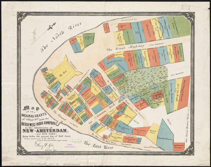
Figure: The Original Land Grants and Patents from the Dutch West India Company.
This map demonstrates that the size of the grants given to New Amsterdam residents was related to how close they were to the fort and port. It demonstrates that the standard lot sizes of 25 feet by 100 feet were part of land use patterns in New York as early as the 1650s. The Grid Plan of 1811 did not dictate lot sizes. Source here.
Leave a Reply