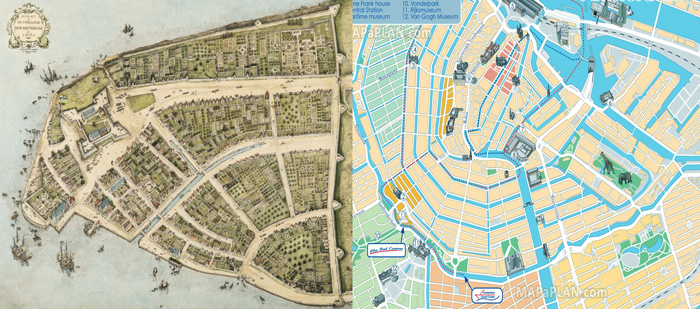
Figure: New Amsterdam in 1660 & Amsterdam Today.
The map on the left shows the village of New Amsterdam. Note how the center of the town starts at the fort and goes east toward the port, and then up to the canal, what is Broad Street today. The west side remained relatively undeveloped during the Dutch period. The majority of the island would remain rural until transportation allowed people to commute from work. Perhaps if the Dutch had kept control of the island, Manhattan would look a lot like Amsterdam today, with its concentric canals emanating away from the center. Sources: New Amsterdam, Amsterdam map
