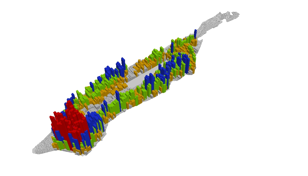
Figure: Population Density across Manhattan in 1900.
This map shows a 3D rendering of population density across Manhattan north of about Chamber Street and south of 155th Street. The greatest concentration of population was in the Lower East Side and the wards just north of City Hall. Source: First Report of the Tenement House Department of the City of New York (1903).
Leave a Reply