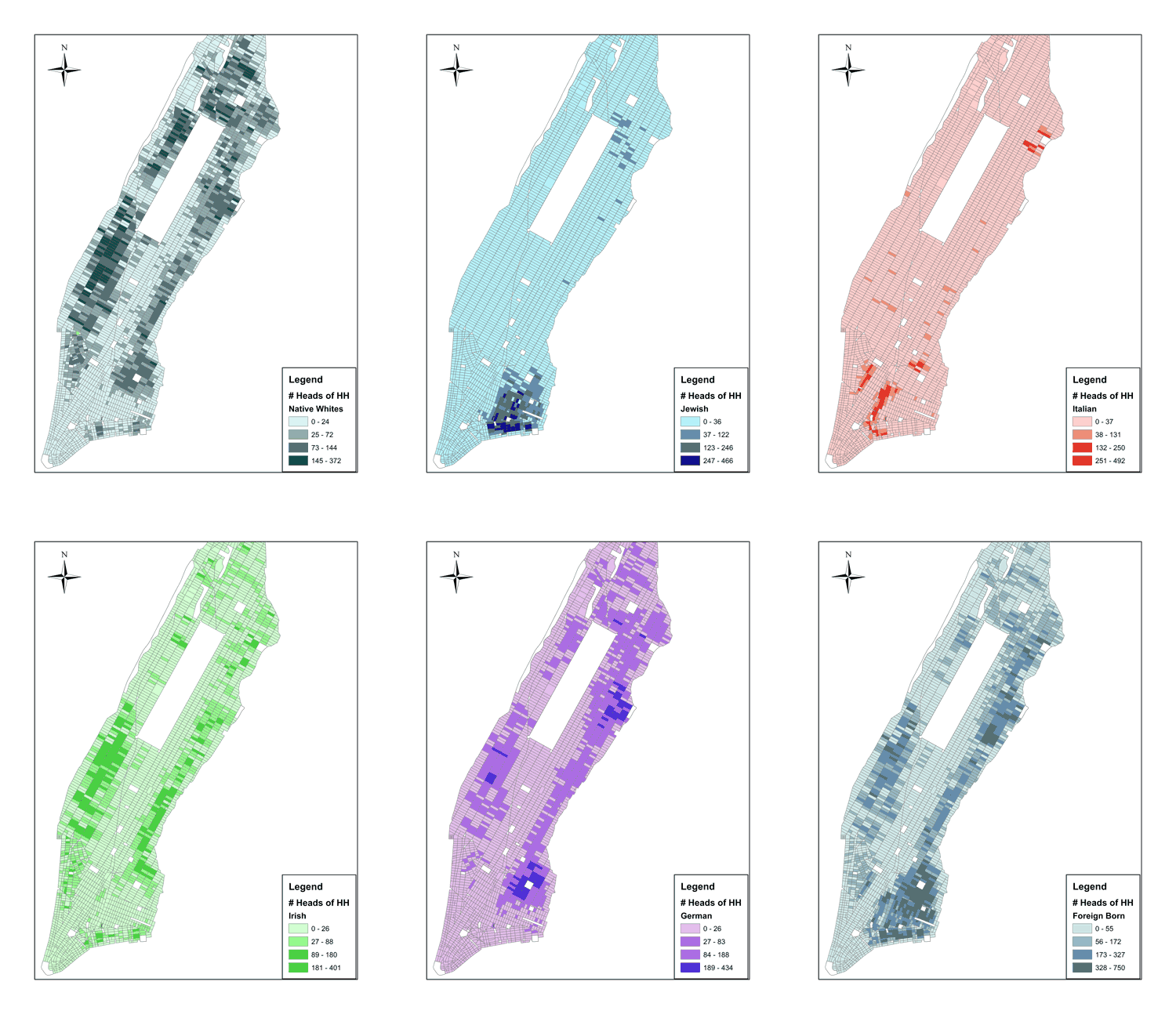
Figure: Population Density by Race and Ethnicity in 1900.
These maps show the relative concentration of ethnic groups in Manhattan in 1900 at the block level. Each maps shows the number of heads of households whose parents were of a particular nationality. The data set was collected as part of the 1900 census and was summarized in the First Report of the Tenement House Department of the City of New York (1903). The Italians were living in the most central area that had the lowest-cost housing. To the northeast of them was the Russian-Jewish enclave. The Irish has formed two enclaves, one on the east side and one on the west. There were two German enclaves: the newer immigrants were living north of the Jewish ward in the historic Kleindeutschland, and a newer, higher-income German enclave existed in Yorkville, just south of Harlem, which also had Jewish and Italian neighborhoods. On average, the location of an enclave was determined by residents’ time in the country, income levels and occupation choices.
Leave a Reply