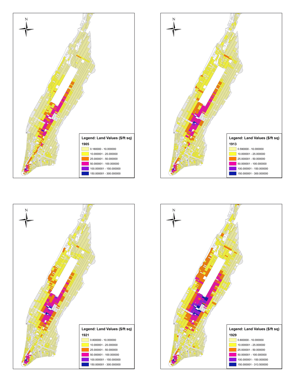
Figure: Land Values: 1905 to 1929.
Land prices measure the value of geography; they indicate what people and businesses are willing to pay for the right to occupy a location in the city. The figures show how the highest land values in the city were downtown and along the central spine. As the 20th century progressed, land values increased in a northward direction, and outward in the Upper East Side and the Upper West Side. Skyscrapers are both a cause and effect of high land values.
Source for land values data: Spengler, E. H. (1930). Land Values in New York in Relation to Transit Facilities. New York: Columbia University Press
Leave a Reply