A few weeks ago, I was walking in Central Park on the Upper West Side. As I strolled past some benches near the Diana Ross Playground, I saw a young man, likely in his late twenties, with his face buried in a huge, white-covered book. When I got closer, I noticed he was reading a brand-new copy of Robert Caro’s 1974, 1,300-page biography, The Power Broker: Robert Moses and the Fall of New York.
It struck me that I was witnessing a quintessentially New York act—to buy the Power Broker and read it in the park. In such an act, we glory in our ability to enjoy ourselves in the vast urban wonderland that is Central Park while reading a book about a man who built more parks in New York than anyone and yet who today is vilified as a power-hungry titan who initiated the fall of Gotham.
The Caro Narrative
It also occurred to me that Robert Caro’s legacy is not just that he provided a chronicle of 20th-century New York’s most important public figure but has also affected the course of public policy.
Caro’s story is about the abuse of power—how Moses transmogrified into a Kurtz-like figure in The Heart of Darkness. Moses began his career as an ambitious idealist Progressive. His genius and endless drive to create parks and parkways pushed him forward and showed New Yorkers how government can improve people’s lives. Yet, with each success, he became increasingly power-hungry and gamed the system to feed his bottomless appetite.
Because of the arrogance that was so basic to his nature…Moses’ susceptibility to the addiction of power was unusually strong….Once Robert Moses had sought power only for the sake of his dreams, only as a means to an end; even then, however, there were signs that he was beginning to seek it for its own sake, as an end in itself. And the avidity with which he sought power—and the lengths to which he went to get it—revealed the depth of his need for it.
After World War II, as Caro’s portrait goes, Moses became deeply entrenched in his “Fortress of Solitude” on Randall’s Island as head of the Triborough Bridge Authority. With a wave of his hand, he clear-cut the “slums” that resulted in massive residential displacements; he ramrodded expressways through vibrant working-class neighborhoods; and his highway construction program drove New Yorkers to become automobile junkies while generating rampant white flight and the collapse of the subways.
Caro provides a gripping tale. We all love a Greek tragedy—the king who becomes so blinded by his power and is convinced of his own perfection that he is unable to see the damage he causes.
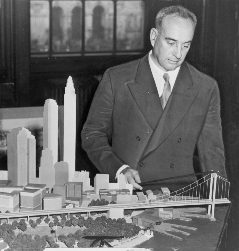
Robert Moses in 1939 viewing a model for a Battery Bridge (a tunnel was built instead). Source: Wikipedia.
The Caro Effect
Yet, whereas Moses, the man, was in power until the early 1960s, Caro’s portrait of Moses has been “in power” since 1974. He hovers as a living ghost that haunts New York and holds vast influence, perhaps more so than the flesh-and-blood version ever did.
This is not to say that Moses’s career was not problematic. His policies were not race- or class-neutral and often harmed people of color and the poor to benefit the white middle class. As a master bill writer, he crafted legislation that left him untouched by the democratic process to implement his programs as he saw fit. He swatted away community pushback with the epithet, “You can’t make an omelet without breaking some eggs.”
Bogeyman Moses
However, the overly simplistic residual of Caro’s book—the belief that people cling to—is that because Moses was a power-hungry bully after World War II and presumably harmed New York, we shouldn’t build important megaprojects that the city needs today (megaprojects that other cities worldwide are building easily).
Because Moses brooked no community input, the logic seemingly follows, we must allow full-on community input, and, by extension, local veto power that stops the city from addressing its problems head-on. The defining legacy of Caro’s book is that we have become paralyzed by the fear of Moses’s ghost which Caro conjured to life.
The Harm
New York faces 21st-century crises that need to be addressed directly and strongly. Most notably, the city must become resilient against climate change, dramatically expand its housing stock, and upgrade and produce other services, including mass transit, to improve quality of life and prevent the high cost of living from pushing people out.
Today, Gotham is tiptoeing its way to climate change resilience. It builds out the shoreline here, adds some bluebelts there, and buys out some households over there. But the truth is that a patchwork of programs only offers partial protection against increasingly damaging storms, flooding, and sea level rise.
New York is on the path toward building $52 billion worth of seawalls that will be used sporadically to stop storm surges. Politically, erecting seawalls away from any residential neighborhood is the easy path, but practically, its cost-benefit ratio is questionable. Billions more will be spent against sea level rise and coastal disappearance.
The Housing Affordability Crisis
Just as important is housing affordability. Over half the city’s renters are rent-burdened, paying more than 30% of their income for housing, and one in three low-income households is severely rent-burdened, paying more than 50% of their income for an apartment. There is hardly any rental housing to be found with the current vacancy rate at a mere 1.4%, the lowest in half a century.
To his credit, Mayor Adams’s City of Yes Housing Opportunity will attempt to add more housing in each neighborhood, but it’s unlikely to have a meaningful impact on affordability. He has to tread gingerly to avoid total rejection of his plan.
Additionally, climate change resilience and housing affordability are not independent. Housing will become scarcer and more expensive as more land is removed from use because of rising sea levels or to mitigate flooding.
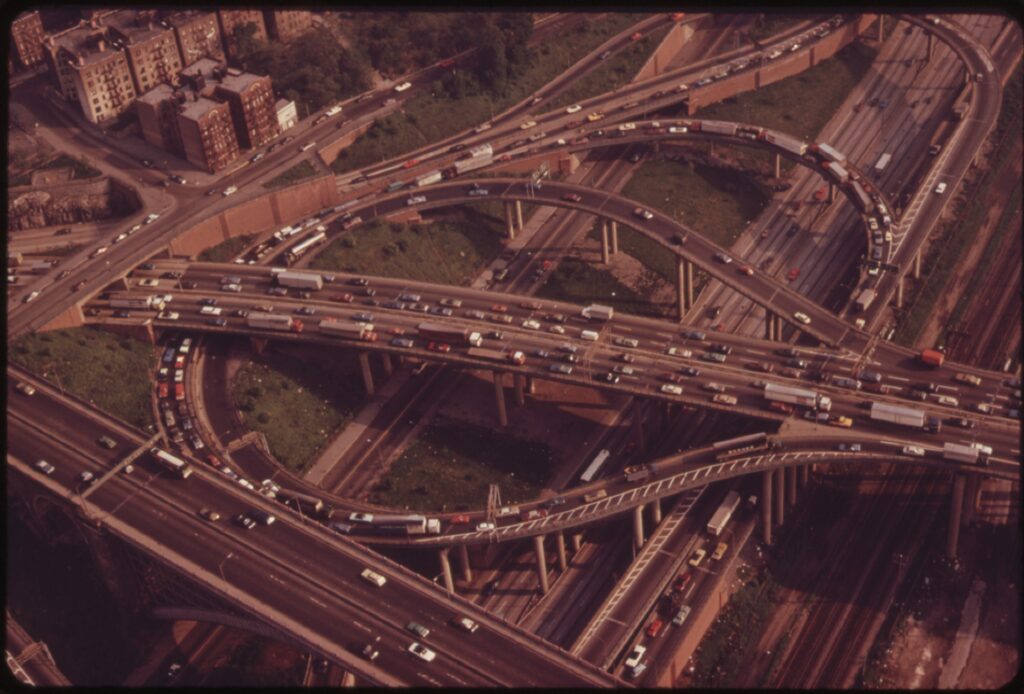
The Interchanges to and from the Cross Bronx Expressway ca. 1973. Source: Wikipedia.
Moses: A 20th-Century Centurion
In the decades following the Power Broker’s publication, there have been more nuanced reevaluations of Moses’s career and impacts. The most forceful and comprehensive is the 2007 book, Robert Moses and the Modern City: The Transformation of New York, edited by Hillary Ballon and Kenneth Jackson (which contains a comprehensive list of Moses’s New York City projects). But the revisionists have been drowned out by the howling of the Caro’s spirit.
Lost in the collective memory is that Moses was a product of his time. He rose out of the Progressive Movement, frustrated with machine politics’ failure to eradicate urban ills like overcrowding and lack of fresh air and sunlight. His genius was in figuring out (for good and for bad) how to overcome nimbyism and status quo politics. He had the support of leaders and the people because he delivered the results that they wanted.
Moses existed within the political spectrum of reformers. On the far left were the socialists who sought to abolish private property. Just to their right were those who wanted to master plan the metropolis, deconcentrate it, and create a network of garden cities. Moses pushed back against those that he saw as being too extreme. He decided that a project-by-project strategy was to be preferred to grand schemes. The populace agreed with him, being suspicious of grand plans that would disrupt the culture of laissez-faire New York.[1]
Slum Clearance
Moses did not invent slum clearance.[2] It had been the dream of reformers since after the Civil War with the rise of hyperdense slums in Five Points. In the 1890s, Jacob Riis’s expose, How the Other Half Lives, provided more fuel to the slum clearance movement.
One of the earliest examples of slum clearance was that of Mulberry Bend, a dense cluster of tenements in the Lower East Side that was notorious for its poverty, crime, and vice. It was cleared in 1904 and the land was converted into a park (today Columbus Park).
When Moses was in his heyday, slum clearance advocates were in positions of power through the New Deal programs. After World War II, Title I and public housing funds were made available on a level never seen before in human history.[3] Moses was able to grab the lion’s share for New York. He was largely supported in his endeavor because he was carrying out the work that previous reformers had been unable to accomplish. Moses was their Trojan Horse.
The Automobile
Moses did not invent America’s love of the automobile, and we can’t blame New Yorker’s car addiction on him (and which is certainly no worse as compared to the rest of the country). It’s good that he didn’t get his way in various projects, such as building elevated highways across Greenwich Village and SoHo, and it’s bad that he did not consider neighborhood impacts when helping to build America’s highway system within Gotham’s borders.
But America’s automobile dependence is based on a much larger institutional and cultural framework—subsidies for cheap oil, various Federal Highway Acts (the National Highway Act of 1956 had the Federal Government covering 90% of localities’ highway construction expenses), and the fact that people highly value the personal freedom that comes with cars.
Moses’s radial highway system for New York City was not his invention. As historian Leonard Wallock states:
Far from being novel, [Moses’s] ideas for a circumferential system of roadways were nearly identical to the ones proposed by the Regional Plan Association in 1929, which in turn were based on Edward H. Bennett’s Brooklyn City Plan (1914) and Daniel Burnham’s Plan of Chicago (1909).
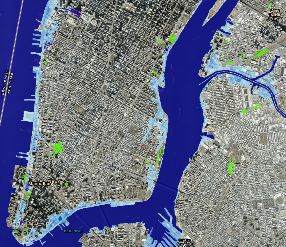
Parts of New York that Will Be Underwater if Sea Levels Rises by Six Feet (a likely projection by 2100). The green areas are those likely to be prone to flooding. Map Source: NOAA.
Moses and “The Fall”
The most influential element of Caro’s book has been its subtitle, “Robert Moses and the Fall of New York,” as if Moses destroyed New York. Yes, Moses did some bad things, and blaming him for Gotham’s post-industrial woes makes for good copy, but it’s just plain wrong.
In fact, after the massive wave of deindustrialization that hit manufacturing cities in the 1960s, New York fared better than most. It lost population from 1970 to 1980 but rebounded after that, and today, the city holds its highest population ever. Detroit and St. Louis, on the other hand, are still losing people. Chicago, Boston, and Newark, for example, have rebounded, but their populations remain far lower than their peak in the 1950s.[4]
More broadly, while Moses is seen as godlike in his impact on New York, the truth is that there was nothing wholly unique about his building spree. As Wallock writes:
In The Power Broker…Moses is not merely the lawgiver but the creator, for he transcends the role of his Biblical progenitor and usurps the place of God. By making Moses the prime mover responsible for the city’s genesis, [Caro’s] interpretations disregard a crucial fact: from the 1920s through the 1960s, New York’s physical and spatial development was markedly similar to that of other large American cities….The Power Broker fail[s] to explain why other cities, not blessed with a Moses figure, assumed the same physical and spatial configuration as New York.
But Caro was writing in the late 1960s and early 1970s when New York was seemingly coming apart at the seams. To many, including Caro, the “fall” was brought about by Moses’s opening the barn doors. In hindsight, this seems to be a confusion of correlation with causation.
Ironically, in his Introduction, Caro hedges on Moses’s net impact, which is quite rich, given how powerful his book has become. He concludes:
Would New York have been a better place to live if Robert Moses had never built anything? Would it have been a better city if the man who shaped it had never lived? ….
Moses himself, who feels his works will make him immortal, believes he will be justified by history, that his works will endure and be blessed by generations not yet born. Perhaps he is right. It is impossible to say that New York would have been a better city if Robert Moses had never lived.
Time to Move On
It’s time to move on. Let’s put Moses in the past where he belongs. We need to learn the true lessons of Moses and use them as a guide to improve New York’s future, rather than clinging to outdated myths that keep the city nearly paralyzed. The true lessons of Moses are that big projects that will benefit New York can and should be built, but they also need to minimize the negative spillovers and unintended consequences and be done in a way that engenders trust and confidence in the government. Getting community input is vital, but community input should not mean complete veto power.
How to Vanquish Moses’s Ghost
However, once lodged in the public consciousness, myths are hard to kill.[5] We long for simple explanations for complex phenomena, and when the “truthiness” of the simple explanations is strong, we cling to them. Blaming Moses for the planning mistakes of the 20th century is easy because he stood in the center of these changes and was seemingly waving his magic wand like Lord Voldemort.
So, how do we remove the Moses Myth from blocking policies needed to keep New York safe, affordable, and viable in the 21st century? I believe the answer is twofold. One approach must come from the top down and the other from the bottom up.
Trust Building
First is that our leaders need to engender trust. Nimbyism is, in large part, motivated by a failure of confidence that the government will do what’s good for individual residents and that large-scale building projects will do more harm than good. The legacy of Moses and Caro was to remove this trust.
Enabling communities to have strong veto power over large projects forces policymakers to employ half-hearted measures instead. When these measures fail to achieve their purpose, residents blame the government for its inability to solve problems, thereby reinforcing their mistrust.
Leaders need to say, “Yes, people like Moses were heavy-handed and their decisions led to projects that today we feel were poorly implemented, but we must move forward. Some large problems require big solutions, and we can’t tiptoe our way to the future. The cost of inaction is much greater than the cost of action and we have learned from the mistakes of the past and will not repeat them. Here are the ways that we have your back….”
Just as importantly, leaders need to create the institutional mechanisms that will bring residents and communities on board. Community input is vital and should be part of the bargaining process. However, all large-scale policies need to lay out the costs, benefits, and the likely negative spillovers, and directly address how these spillovers will be mitigated to reduce the fear of change. (I have spelled out examples here). One mechanism is that a large project also comes with a compensation fund to which people can apply if directly harmed and which is objectively administered by an impartial board.
Rebranding Moses
While leaders work on the issue of trust and compensation, we, the people, need to rebrand Moses and reframe how he is seen in the public eye.[6] Yes, Moses did many things that, in hindsight, were regretful. But he also did many wonderful things. What’s wrong with a story about a complicated man who was a product of his time?
We need to change the narrative. We need to get the word out that Old Man Moses died in the 20th century and we refuse to be afraid of the Spooky Ghost Moses. Let’s put him in the history books along with other 20th-century figures like Al Smith, Franklin Roosevelt, and Fiorello La Guardia. It’s time to create a future with new leaders who help build New York by incorporating the lessons from the best version of Moses while leaving behind those from his worst side.
—
Notes
[1] When Jane Jacobs emerged on the scene in the early 1960s, her antidote to planning was to eliminate it altogether. Death and Life directly response to the wide-eyed planners who wanted to remake the city from scratch or to build towers in the park. Her “cure” for neighborhoods was to leave them alone (or allow residents to veto any new construction) and permit mixed uses. In terms of city planning, her recipe for utopia was to build more playgrounds and cut long blocks in half to create more sidewalks and street frontages.
[2] Moses did not invent the tower-in-park style of housing either. It was an invention of reformers and visionaries, such as Le Corbusier, starting in the 1920s. The planning consensus during the Great Depression and beyond was that building towers surrounded by green space would cure urban ills.
[3] Arguably federal mortgage programs that created redlining and with which Moses was not involved had a greater effect on cities like New York than Moses’s housing and slum clearance projects.
[4] Ironically, public housing—something in which Moses had a more behind-scenes role in developing—today is a success story in New York. Given the massive affordability problem, NYCHA housing provides a huge benefit for those with low incomes. See Nicholas Dagen Bloom’s book, Public Housing that Worked: New York in the 20th Century. More broadly, given recent economics research on the impacts of highways (such a Brinkman and Lin, 2024) and slum clearance on cities (such as Collins and Shester, 2013), measuring the net impact of Robert Moses on New York relative to what happened in other cities, would not be too difficult. To my knowledge, no one has specifically measured whether Moses’s projects were a net plus or negative for the city’s economic growth.
Many cities around the world are facing housing affordability crises. In New York, for example, a majority of renters are rent-burdened, meaning their housing costs eat up more than 30% of their income. Even worse, nearly one in three low-income renters are severely rent-burdened, spending more than 50% of their income on housing.
To his credit, Mayor Eric Adams is pushing his City of Yes Housing Opportunity agenda, which, if approved, would allow for more housing throughout the city. These rezonings will produce up to 100,000 additional units over the next 15 years, if all goes well. While this may sound like a lot, it’s only about 6,700 units per year, on average—hardly what’s needed to make a meaningful impact in affordability.
Where to Build?
One of the biggest hurdles is finding new sites on which to build housing. With only a slight bit of exaggeration, we can say that current housing is where future housing goes to die. In other words, when housing is built, it creates barriers that make future, denser buildings more difficult to construct.
Tenants in rental buildings, for example, would need to be evicted or relocated, which is frequently impossible as retnal laws give tenants the right to remain in their units (and with New York City vacancy rates at 1.4%, where will they go?). In suburban areas, zoning for single-family housing dominates, and densification is nearly impossible (more than 50% of residential land in New York City is zoned for one- or two-family homes and is likely much higher outside the city boundaries).
Last year, Governor Kathy Hochul introduced a bill to upzone parcels near transit lines around the state. However, it was voted down by the state legislature because suburban residents are opposed to having multifamily buildings in their towns or neighborhoods. Mayor Adams’s City of Yes Plan is now working its way through the legislative process. It remains to be seen if key parts will be gutted because of local opposition.
Lower Manhattan with Map of New Amsterdam Superimposed. Manhattan Island has been dramatically expanded over the centuries by landfill. Source: Created by Jason Barr from the 1660 Costello Plan and Google Maps.
New Mannahatta
However, there is another option that we can add to the list—creating housing on new land.
In the long sweep of urban history, when cities have been land constrained, they have frequently made more of it by draining wetlands or building out the shorelines into the sea. The process of land reclamation is as old as civilization itself.
The proposal was greeted, of course, with a flood of skepticism. Much of the knee-jerk nay-saying was based on the idea that my plan was too radical. However, I don’t think most people realize that land reclamation has been part of New York’s DNA since New Amsterdam was founded in 1624 and has continued well into the 20th century. Lower Manhattan south of City Hall is about 50% bigger than it was before the Dutch arrived. In fact, there’s nothing wholly original about my proposal as it follows a long line of such proposals (discussed below).
Second, a tour around the world (to be discussed in Part II of this series) will show how common reclamation is in cities seeking to grow and accommodate their populations (I will discuss the environmental concerns in Part III of this series).
The Ghost of Moses
Today, American cities are mired in paralysis—residents are afraid of mega-projects that could substantially benefit us. People in New York constantly chime in about how the city was, so to speak, bitten by the snake of Robert Moses, the master builder of New York from the 1930s to 1960s. Because Moses was heavy-handed and power-hungry in the mid-20th century, the logic goes, we can’t do big projects today.
So, I want to demonstrate in this blog series that land reclamation for urban expansion and new housing is not only an age-old tradition but something we should consider for our future. Let’s turn to New York’s history.
Jason Barr’s Proposal for a Manhattan Extension. See here for more details.
New Amsterdam
When the Dutch created New Amsterdam on the southern tip of Manhattan in 1626, one of their first acts was draining the wetlands along the shoreline (today this is a bad idea, but I’ll return to the environmental issues in Part III). They dug a canal from a creek that ran down what is Broad Street today and shored up the coastline. Elminating wetlands was also seen as good for public health to prevent insect-borne diseases. By draining these wetlands, they created new land, and the canal allowed boats to enter the city itself.
Another early act was to build a fort on the lower tip of Manhattan (today, where the Museum of the American Indian resides). As the map above shows, by 1660, the Dutch had transformed Lower Manhattan into a hub for commerce and defense (and the seat of government). If the Dutch had remained in control of the colony and had not lost it to the English in 1664, Lower Manhattan would likely be ringed by a series of canals, like its father city in the Netherlands.
When the English arrived on the scene, local officials sold off so-called water lots—those parts of the shoreline that were exposed during low tide—to private landowners, who would create a retaining wall and fill in the land. Over time, water lots were sold further and further out.
Land creation had multiple purposes. First, it provided new real estate to help the city grow. Additionally, since the new land was now in deeper water, ships laden with merchandise could dock at the wharves and piers rather than anchoring further away and transferring their wares on barges, thus reducing transportation costs and creating a bustling port.
On the eve of the American Revolution, British New York had added nearly five hundred acres of land along the Lower Manhattan shorelines. As the historian Ann Buttenwieser writes, “Ballast was dumped and ships sunk, hills leveled, building sites and roadways excavated, wastes, ashes and sweepings collected, and all were deposited at the water’s edge. When space was needed for services, work places, homes, or recreation, it was always possible to create more land.”
Over the last two-thirds of the eighteenth century, the harborside facilities of New York were transformed. Two full blocks were reclaimed out of the East River. The city once had ended at Pearl Street; by the end of the century, Front Street was the southeastern border of lower Manhattan.…It is a certainty, however, that waterlot grants were used, as they were designed, to provide New York City with the streets, wharves, and port facilities of a growing seaport.
The Dutch fort (though rebuilt) remained a defensive location for the English as well. Colonial Governor Thomas Dongan began building batteries along the shore in 1683, giving the area its name. In 1788, the fort was demolished, and the rubble was used as landfill to create a public promenade. Between 1808 and 1811, a new, circular fort was built 200 feet offshore on an artificial island to prepare for the War of 1812. Originally called the West Battery, it was re-named Castle Clinton in 1815. In 1824, it was repurposed as Castle Garden, and became a popular entertainment venue and beer hall.
During the 1840s, as people began clamoring for more park space on Manhattan, the idea of infilling the area between the Battery and Castle Clinton took hold. Battery Park was thus created with landfill, uniting Castle Garden island with Manhattan. From 1855 to 1896, Castle Clinton operated as the city’s official immigrant processing depot before Ellis Island opened.
Over the course of the 19th century, New York continued to expand it shorelines. In 1865, the engineer Egbert Viele published a topographical map, which shows how much of the city had been expanded through fill up to that point. Many housing projects built in the 20th century, like Stuyvesant Tower and the Lillian Ward Public Houses on Avenue D in Alphabet City are on land reclaimed in the 19th century.
The Viele Map with Some Modern Developments Built on Made Land.
The World Trade Center
After World War II, the Port Authority of New York and New Jersey (PANYNJ) moved the city’s port to the New Jersey side of the Hudson River, which could accommodate the large container ships. Between the declining fortunes of Manhattan’s port and the aging Art Deco offices, Lower Manhattan was falling on hard times.
In 1957, David Rockefeller, Chairman of Chase Bank and grandson of oil baron John D. Rockefeller, spearheaded the creation of the Downtown Lower Manhattan Association (DLMA) to help revitalize Lower Manhattan. The DLMA commissioned Skidmore, Owings & Merril (SOM) to create a master plan, which included a World Trade Center and office and exhibition space near the East River south of the Brooklyn Bridge. The DLMA turned to the Port Authority as a natural agency that could spearhead construction.
After protracted negotiations and “slum clearance,” the PA took control of a 15-acre (6-hectare) site on Manhattan’s lower west side and built the World Trade Center, including the Twin Towers, on landfill created in the 19th century.
Left: Battery Park City Landfill ca. 1970. Right: Waterside Plaza Housing Development. Sources: here and here.
Battery Park City
Excavation for the World Trade Center produced a lot of material that had to go somewhere. Thus, the idea of creating a new neighborhood, Battery Park City, emerged by reusing the fill for new land next to the World Trade Center site. However, the plan was expanded to 92 acres (0.37 km2) and only a quarter of the fill came from World Trade Center site.
The Battery Park City Authority developed the complex, which was formed in 1968 by the New York State Legislature. While the neighborhood took a while to be fully built out, today, it is hailed as a success story of how to create a mixed-use neighborhood from scratch. The site contains 9,300 residents in 30 residential towers, 10 million square feet of office space, parks, museums, a marina, and a riverside promenade.
Waterside Plaza
Another example of a successful housing development is Waterside Plaza. In 1973, twelve years after it was first proposed, the “ambitious and dramatic Waterside housing development over the East River was formally opened…by Mayor Lindsay and former Mayor Robert F. Wagner.” The project contains 1470 residential units within three towers and rows of townhouses on a six-acre platform built over the East River. Two thousand steel piles were sunk 80 feet in the riverbed to support the platform. Many units are reserved for middle- and low-income households, made possible by various housing subsidy programs.
Visions of a New New York. Starting in 1911, the engineers T. Kennard Thomson offered several visions of expanding New York City through land reclamation. Source: NYPL.
The Unbuilt Future
Producing visions of expanding Manhattan is something of a cottage industry. In fact, despite the shock created by my Manhattan expansion proposal, there’s not all that much original about it. What is unique is that it has been updated to reflect our current needs: protection from climate change and the need for more housing.
Arguably, the most brash—much more so than mine—was proffered by the engineer T. Kennard Thomson in 1911. He proposed to dam and fill in the East River while also expanding Manhattan and Brooklyn four miles into the harbor. His plan added new peninsulas on Staten Island. And, he proposed digging a canal from the Long Island Sound to Jamaica Bay and moving the city’s port to southern Queens.
Thomson argued that “The method of reclamation to be followed is extremely simple. I would merely erect concrete seawalls from the Battery toward Staten Island for the desired length, and then fill them in.”
In 1921, the New York Times reported on a scaled down version of the plan, which was simply the Manhattan extension part—four miles into the harbor (my plan is a mere 2.5 miles). The consensus among the panel of lawyers, planners, and engineers was that there were no legal or engineering barriers to building it, and that new land would help the city grow and reduce congestion.
In 1924, engineer John A. Harris proposed damming up the East River and creating new land in place of the river (and a canal to the east running through Brooklyn and Queens). The centerpiece of his proposal was a vast new civic center and arts complex on top.
New Land for New Cities
While land reclamation has been part of New York’s long history, many cities around the world are using it to expand their cities. In the next post, I will discuss what’s happening globally.
Cities in the Sky tours the world’s greatest cities, from Chicago to New York to London and then to Asian metropolises, to see why they are building their skylines. Along the way, the book busts myths and misconceptions about skyscrapers. Cities in the Sky addresses the good, bad, and ugly for cities that have embraced vertical skylines, offering a glimpse into the future to see whether cities around the world will continue their journey upward.
“With a global view and his eyes cast skyward, Barr provides an enjoyable, expansive study of a subject he loves.” —Kirkus Reviews
Ever Upward
Skyscrapers remain controversial in the 21st century, yet they’re becoming more numerous and taller. Since 2000, seven times more skyscrapers (150 m/492 ft. or taller) have been completed worldwide than in the entire 20th century.
The Empire State Building, the world’s tallest structure for 40 years, is now ranked 53rd. The Willis (Sears) Tower was the record holder from 1974 to 1998, but today, it ranks a mere 25th. The Burj Khalifa, the current world’s tallest, is twice as tall as the Empire State Building, at 828 meters (one-half mile).
We are climbing our way to the heavens.
Why Do We Build Upward?
But why do we build upward? The short answer is that the humans of Planet Earth have been getting wealthier. In 1960, per capita gross domestic product (GDP) was $3,600. Today it’s over $11,000. Intimately tied to this economic growth is the corresponding rise in urbanization. In 1960, the world population was three billion, with two out of three people living in rural areas. Today, the world population is eight billion, and nearly 60% of us live in urban areas. In other words, six decades ago, the world’s cities housed one billion people. Today, they hold nearly five times that amount. Urbanized living is our present and future.
And why do these cities exist? Because they are our economic, social, and cultural engines. Manhattan alone—a mere 23 square miles—generates 3.3% of the United States Gross Domestic Product (GDP). Shanghai accounts for 3.7% of China’s GDP, while London generates a whopping 20% of the U.K.’s GDP.
Book Cover for Cities in the Sky by Jason Barr. To be released by Scribner Books on May 14, 2024. Pre-order here.
The Ecosystem
People move to the cities for jobs but stay for socializing, education, and consumption. In this way, vibrant cities generate positive feedback loops. Companies set up shop and hire workers, who then spend their income on food, clothing, shelter, and fun. Their money circulates locally, creating more jobs, and so on. Vibrant economies attract more people and companies, and the economic growth continues. Density also creates a whole host of positive spillovers—people learn from each other and become more productive, and cities can offer a wider variety of goods and services than otherwise.
But what is a city? It’s fundamentally an ecosystem—a place where people live and work, along with the institutions that support them: buildings, transportation, access to goods and services, social networks, governmental services, and so on. If we want to understand why so many skyscrapers are rising, we must see them as one component of the urban ecosystem.
Since cities are dense clusters of humans who frequently want to be at the same place at the same time because of a location’s convenience to other people or amenities, the only way to accommodate this demand is to go upward. To take an example, a quarter-acre (1,012 m2) lot can reasonably shelter 25 people. But if the location is in high demand, then stacking those shelters by creating 20 “lots” (i.e., floors) on top of each other can hold 500 souls. The skyscraper pinches geography by producing land in the sky.
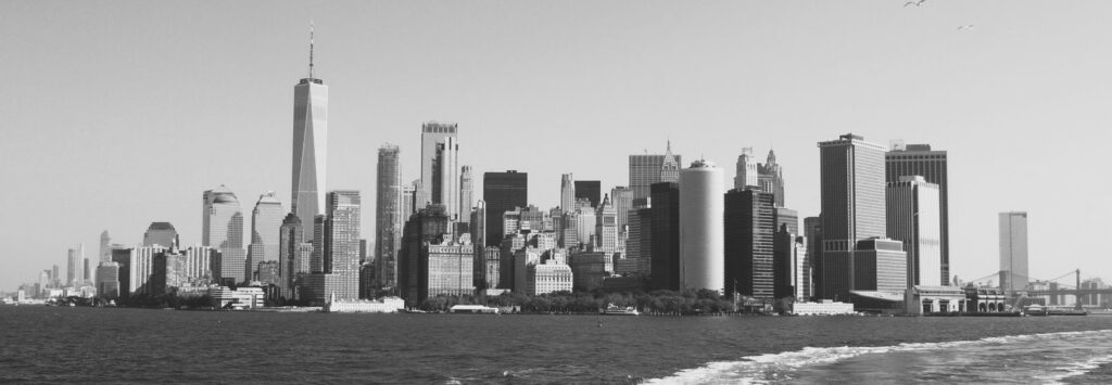
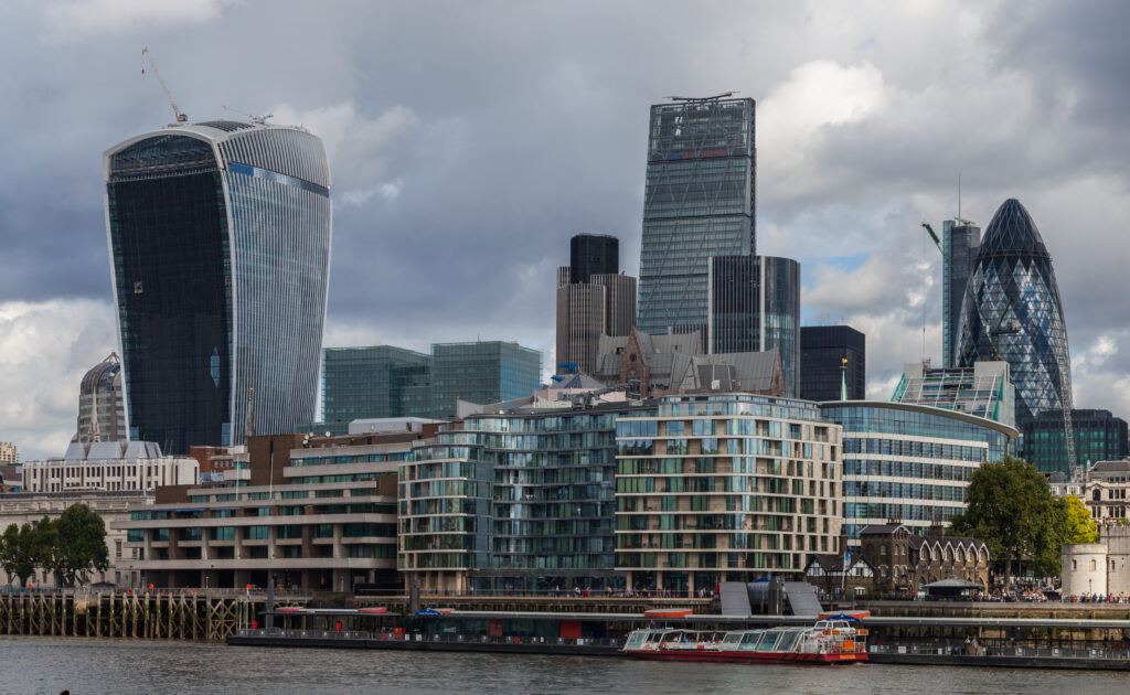
Lower Manhattan Skyline. Photo by Jason Barr.
Cities in the Sky
Chicago, 1885
In Cities in the Sky, I take a global view to put the skyscraper in a larger historical context. In Part I, I begin with the birth and growth of the tall building in the late 19th century and early 20th century. First, we visit Chicago in the 1880s to see if the Windy City was really the birthplace of the skyscraper, as the conventional wisdom would have you believe. The answer is not so clear—New York and Chicago were each developing the technologies at about the same time.
But what is definitely true is that the Home Insurance Building (1885), designed by William Le Baron Jenney, was NOT the first skyscraper. Instead, its designation as such resulted from a public relations campaign by the Chicago School architects who decided to circle the wagons around Jenney because they wanted to box out other claimants.
New York, the Roaring Twenties
Then, from Chicago, it’s off to Roaring Twenties Gotham, where we visit the Empire State Building and chronicle its rise to become the world’s tallest building. Though the building was half empty during the Depression and was labeled the “Empty State Building,” the truth is that the building has been very profitable over the long run. The skyscraper was not so much a vision of grandeur but rather a grander vision that benefited Gotham and has served as an inspiration to the rest of the world.
Just as crucial for skyscraper history was New York’s implementation of zoning regulations, which paved the way for cities to find a balance between the benefits of tall buildings and regulating some of their downsides, like shadows and congestion. The 1916 codes incentivized the wedding cake style because skyscrapers had to be set back as they rose to allow more sunlight on the street. The regulations inspired the Art Deco aesthetic, the second modernist movement after the Chicago School of Architecture.
In 1961, New York implemented a new set of codes by regulating the so-called Floor Area Ratio (FAR), which limited the amount of floor area that could be built on each lot. The FAR was popular, and today, it is arguably the most important skyscraper regulation worldwide. By regulating building bulk, the FAR encouraged the third modernist architectural style, the International Style glass box tower.
Post-War America
Then, we visit post-war America. The real “hero” of the skyscraper after World War II was the computer. For the first time in human history, computers could be used to work out the physics of tall buildings. They allowed architects and engineers to devise strategies to go taller for lower costs. The computer thus led to what I call the Second Skyscraper Revolution, a new suite of technologies and design methods that gave rise to the next crop of the world’s tallest buildings, the Twin Towers (1972/3) in New York City and the Sears (Willis) Tower (1974) in Chicago.
And just as important for world history, America demonstrated that growing cities needed tall buildings to house their companies and to signal their economic might. By the late 1990s, the skyscraper spread like a wave across the rest of the planet. In Part II of the book, we take a grand global tour.
The London Skyline. From left: The Walkie-Talkie, the Cheesegrater, and the Gherkin. Source: Wikipedia.
London: From No to Yes
The next stop is London, which provides a fascinating case study regarding tall buildings. In 1894, just as all the technologies needed to produce skyscrapers became available, London banned them by instituting a height cap of 80 feet. If you ask architectural historians why this is so, they will invariably say that the conservative London architects, who sought to preserve the U.K.’s imperial tradition of classical buildings, would not deign to build new-fangled towers like their Yankee upstarts across the pond.
While this is true to a degree, when we drill down into the economics of London’s business district, we see it had something New York did not have: space. The City of London was able to accommodate its business growth because it had more land. The conservatives and anti-skyscraperists were able to hold sway because the economic pressures were never as intense as in Lower Manhattan or Chicago’s Loop.
Then, during the 20th century, after the Blitz Bombing, much of London’s building stock was destroyed, and the city could be rebuilt without supertall towers. But all that changed in the 21st century. London was running out of space, and the answer was to go upward with iconic skyscrapers—the Gherkin, the Cheesegrater, the Shard, and the Walkie-Talkie, to name a few.
Living Densely in Hong Kong
The next stop is Hong Kong, where we see how it became the densest city on the planet with the highest concentration of skyscrapers anywhere. The reason is due to is combination of land shortages, its history as a British-controlled Chinese city, and its unique land ownership system.
Hong Kong was always “land poor”—being mostly hilly territory. When mainland turmoil hit, Chinese residents flooded the colony, seeking employment and refuge. After World War II, British officials realized the only way to accommodate the deluges and to keep the colony profitable was to build upward. The process began with public housing, which, unlike in the U.S., has proved an enduring success. Officials then invested in mass transit and horizontal connectivity to make Hong Kong truly a 3D city.
China: Skyscraper Fever
Then off to mainland China, which has undertaken the largest skyscraper construction project in human history. There is no way else to put this except to say that China has “Skyscraper Fever.” The massive urbanization that has unfolded since the economic reforms initiated in 1978, combined with its particular method of governance, has led China to embrace the tall building bling like no other country.
But its love of the skyscraper has come with a cost. Today, China’s real estate market is in desperate straits because of the overbuilding. Leaders are scrambling to contain the damage. And in 2020, the Community Party banned buildings taller than 500 meters (1,640 feet), and dramatically reduced the number of buildings above 150 meters (492 feet). But if there is one key lesson in skyscraper history, it’s that gluts eventually lead to shortages and shortages back to booms. Stay tuned…
Arabian Heights
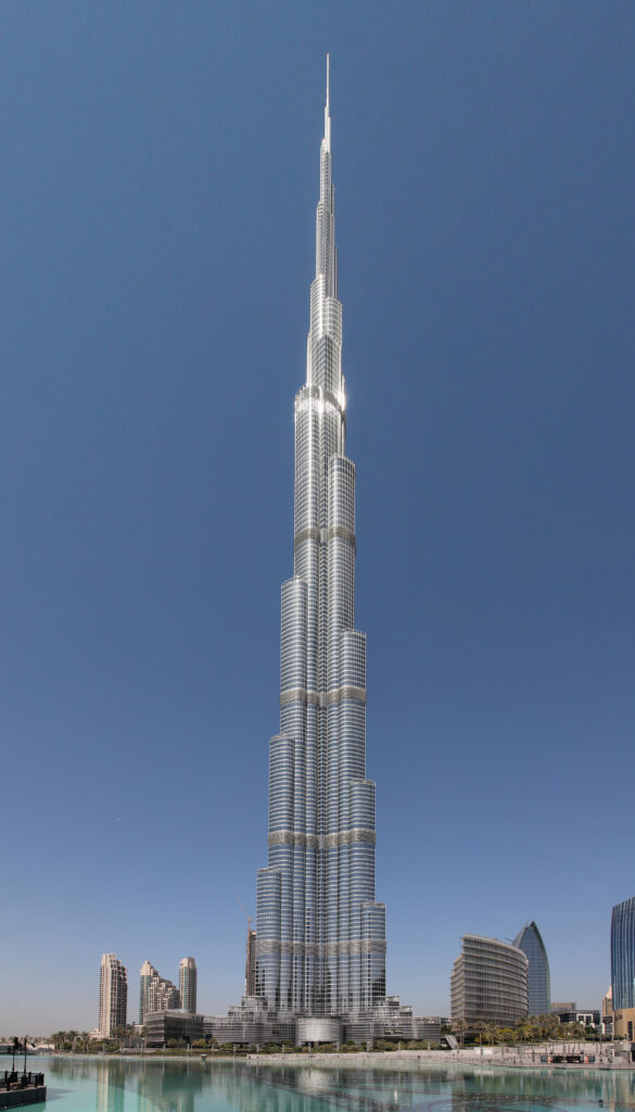
After China, we head to the Arabian Peninsula to visit the world’s tallest building, the Burj Khalifa, at 828 meters (0.5 miles) tall. While most people see this building as an example of the craving for spectacle and egos gone wild, the truth is a bit more complex. Yes, the structure was built during a real estate boom, but its construction was meant to help put Dubai on the map as a business and tourist destination.
When we look at the economics of the project, we can see that it represents the same kind of maniacal genius that gave rise to the Empire State Building. Seventy percent of the tower’s residential units sold out before the crash; the observatory is a cash cow, and the surrounding properties with a Burj view are worth thousands of dollars more because of that view.
The tower’s success has not been lost on Saudi Arabia, which realizes it must move quickly to wean itself off its oil addiction. The crown prince, Mohammed bin Salman, is using mega projects to lift the country by its bootstraps. In 2010, the nation started to build the world’s tallest building, the Jeddah Tower, but then political turmoil led to its halt. If restarted, it will be the world’s tallest tower at one kilometer (0.62 miles).
In the meantime, the kingdom is building other mega projects like The Line, which is proposed to be 500 meters (1640 feet) high, 200 meters (656 feet) wide, and 170 kilometers (106 miles) long to house nine million people! Will Saudi Arabia succeed in this unbelievable project? It’s hard to say, but the truth is that great cities typically spring from the ground up and not from the spire downward.
In Part III, we take a step back to look at the good, bad, and ugly of tall buildings, asking why we are building them, how they should be regulated, and what’s in store for the future.
The reason tall buildings are growing worldwide is the benefits they provide. They allow us to more easily enjoy the fruits of the city, and provide amazing views. But why is the idea of stacking people—the creation of high-rises—so controversial? One claim—particularly in Western cities—is that they seem to generate gentrification, displacement, and inequality. There is some truth to this, but the real story is more complex and nuanced.
Gentrification and luxury condos must be understood within the larger economic context. Income inequality, for example, should be addressed by making tax rates much more progressive and improving employment opportunities for those at the bottom of the economic ladder. Housing affordability needs to be improved by building abundant housing for everyone—across the income spectrum and entire metropolitan regions.
If more housing is built in the suburbs and that lowered land values in the center, we might get fewer tall buildings there. And that’s perfectly good and right. While new supply everywhere helps, it’s more critical to build affordable housing where it’s most needed. Similarly with CO2 production, yes tall buildings emit a lot of CO2, but overly stringent regulations that cap heights, for example, generate sprawl, which is even more carbon intensive. Policies need to tax carbon for all producers and subsidize clean energy production.
The Future
Over the long run, however, as technology has progressed, we can erect buildings that are not only taller but are also more functional—and for lower costs. The improved supply conditions combined with the rising tide of urbanization means that taller and taller buildings will continue to be brought forth in the world’s greatest cities. But at the end of the day, cities succeed when they bring us together and make us more productive. If designed well and built in the right locations, skyscrapers can help us achieve that goal.
You can order Cities in the Sky: The Quest to Build the World’s Tallest Skyscrapers here.
[Note this post is a part of a series on the history of New York’s grid plan. The entire series can be found here.]
Manhattan 1.0
In 1811, the Street Plan Commissioners produced Manhattan’s grid system. Accompanying their map was a brief set of remarks highlighting their decisions. First, they felt a gridiron plan was best because “straight-sided and right-angled houses are the most cheap to build and the most convenient to live in.”
Second, they believed there was little need for abundant park space because “those large arms of the sea which embrace Manhattan island render its situation, in regard to health and pleasure as well as to the convenience of commerce, peculiarly felicitous.” Lastly, they decided to stop at 155th Street because “it is improbable that (for centuries to come) the grounds north of Harlem Flat will be covered with houses.”
Manhattan 2.0
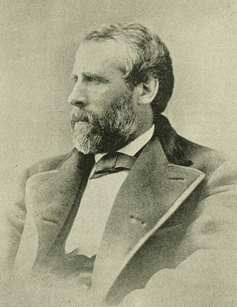
Ironically, one man in the second half of the 19th century would be largely responsible for “reversing” or adjusting those choices in Manhattan and beyond. That man was Andrew Haswell Green, one of New York’s most important but least-known leaders who helped to shape, both literally and figuratively, the path that New York would take in the second half of the 19th century.
Green would oversee the creation and expansion of Central Park from 1857 to 1870. He would also be responsible for laying out a street plan north of 155th Street and would help influence street planning and parks in the Bronx. In essence, he was Grid Commissioner 2.0, altering New York’s landscape beyond the repetitive street layout.
Just as importantly, he was a forceful advocate for the city’s physical expansion, which led to New York first annexing the Bronx and then, in 1898, to the final joining with Brooklyn, Queens, and Staten Island to create the City of Greater New York. The new municipality would have the power to plan and layout streets and coordinate transportation and infrastructure, enabling Gotham to become one of the world’s greatest cities.
Green was born in 1820 on the family farmstead near Worcester, Massachusetts. He moved to New York when he was 15 and eventually studied law under the tutelage of Samuel Tilden, a well-known lawyer and politician. After a successful law practice, Green moved into government service, emerging as one of New York’s most influential civic leaders. Though he was a Democrat, he was opposed to the corruption and excesses of the Tammany Hall wing. His sweeping plans gained wide support from Albany’s republicans and city reformers eager to check Tammany’s corruption and provincialism.
Green was known as an honest and capable administrator. If anything, he had a reputation for extreme frugality, as he strongly felt that the government should administer public works with the least amount of expenditure. New York City historian Thomas Kesner describes him as,
Self-righteous in the extreme, he kept few friends while gaining many admirers for his versatile skills in municipal planning and his undoubted integrity. Severe, demanding, caustic in debate, with a reputation for cantankerousness, he could be very persuasive in person and even more so in his writing, which had greatly improved over the years.
His first foray into public service was as a member of the Board of Education from 1855 to 1860, becoming its president in 1857. Then, he was drafted into the state-appointed Central Park Commission in 1857, which was charged with creating a green oasis on Manhattan Island.
Indeed, for the twenty years between 1857 and 1877, he would be identified with almost every major project aimed at municipal improvement, ranging from Central Park and Brooklyn Bridge to New York’s annexation of a portion of lower Westchester and the reform of municipal administrative practices.
In 1870, Green moved into citywide government as comptroller and was instrumental in rehabilitating the City’s budget after years of graft, corruption, and a general feeding at the public trough during the reign of Tammany leader, William “Boss” Tweed.
After 1811, as the grid began to “eat” Manhattan, it became clear to many that the street plan was a juggernaut, devouring the natural world in its path and ignoring many of Manhattan’s topological and ecological features. Streams were buried, hills were leveled, marshes drained, and forests cut down.
As a result, by the late 1840s, there was a movement for Manhattan to have a large park. In 1853, New York State passed a law to take 778 acres of land through eminent domain. In 1857, the state legislature established a Central Park Board of Commissioners to begin the planning process.
The Zeitgeist
Having a large park was seen as vital for many reasons. The first, of course, was to undo the omissions of the 1811 plan. But just as important was the social and economic context. Urban reformers witnessed the poverty and dislocations in neighborhoods like Five Points and the Bowery and felt the masses needed a becalming natural outlet.
In Europe, revolutionary activity was in the air. American reformers worried that without some palliative balms, the American apple cart could be, so to speak, easily turned over. The rich also wanted the pleasure grounds for their Sunday strolls and horse races. Collectively, the wealthy, the propertied interests who wanted to reap the benefits of higher land values, advocates for the poor, and urban reformers united to turn the movement into a reality.
A Green Park
Green was initially appointed a board member but then was made president and treasurer in 1858. In 1859, he became the park’s comptroller, a newly created position that allowed Green to be, effectively, the Central Park CEO. Under Green’s leadership, the Commission surveyed and assessed 34,000 lots owned by 561 property owners, 20% of which were owned by three families. The Commission paid $5 million for the parcels, three times what leaders assumed the park would cost. One-third of the park’s construction cost was paid for by abutting property owners through special tax assessments.
Squatters had to be removed. As historians Edwin Burrows and Mike Wallace recount, “The sixteen hundred or so Irish, German, and blacks who lived on the land—dismissed and disparaged as ‘vagabonds and scoundrels’—were evicted by 1857.” Today, historians are recovering these residents’ forgotten histories.
For example, the land between 82nd and 85th Streets on the west side of the park was the home to Seneca Village, which was a successful lower-income cluster of dwellings far north of the city proper. One resident was Andrew Williams, the first African American to purchase land in the area in 1825. He lived in the village with his family and other black residents.
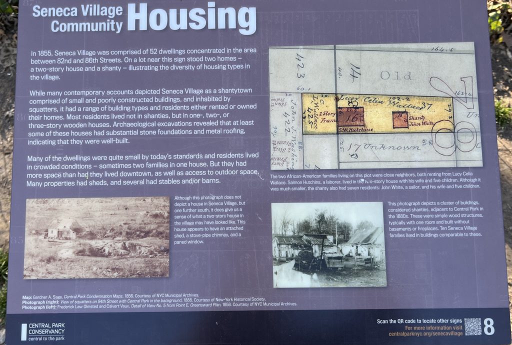
Seneca Village. On the West Side of Central Park between 81st and 85th Streets was a small settlement far above the city. Its residents were scattered when the Central Park Commissioners bought the land to create the park. Source: Photo by Jason Barr of sign in Central Park.
Green and Greensward
To find a design, the Central Park Commissioners sponsored a competition. Green was a leading voice that led to the choice of Frederick Law Olmsted and Calvert Vaux’s design. As Mazaraki writes, “[T]heir Greensward Plan proposed a reformer’s vision—a space designed to school both patrician and plebeian cultures by transmitting, almost subliminally, civilized values and a ‘harmonizing and refining influence.’”
No commercial activity was allowed inside its boundaries. Four transverse roads would be built below grade to allow the park to remain seamless from south to north. Within its acreage, there would be a wide range of uses, from promenades to wooded glens and hills to open fields.
Olmsted was also chosen as the park superintendent to oversee the implementation of his plan. Olmsted, whose vision was expansive and expensive, would frequently butt heads with Green, who sought to keep those expenses in check. They would fight and argue, but the finished product was a masterpiece.
The creation of Central Park formed Green’s apprenticeship in city planning. He mastered its every detail as well as the larger vision. For the ten years that he presided over the Central Park Commission, Green set aside his other work to give the project his full attention. He was the commission’s workhorse and its most forceful member. “No one but Green knows,” Olmsted wrote of his sometime adversary, “or will take the trouble to inform himself, of the facts bearing on any question of policy sufficiently to argue on its effectuality….Not a dollar, not a cent, is got from under his paw,” Olmsted would complain regarding his prickly nemesis, “that was not wet with his blood & sweat.”
However, Green was not such a spendthrift that he was blind to opportunities as they arose. He advocated for expanding the park’s northern edge when he saw that the Commissioners could buy the land from 106th to 110th Streets before it was developed, thus adding 65 acres. To encourage the arts, Green invited the Metropolitan Museum of Art to build on the grounds. And Green was instrumental in creating the zoo.
Beyond the Park
Thanks to the success of Central Park—an example par excellence of a well-executed public work with a sublime design—the Central Park Commission was given control of planning outside of the park. In 1858, Green made the case for the opening, widening, and improving of the streets and avenues bounding the park in parallel to the park’s opening. This was particularly important because the northern part of the city was only at 42nd Street, with only a single paved road—Seventh Avenue—above it. The Park Commission opened Seventh Avenue from 110th Street to Harlem River, along with Central Park East and West.
The Park Commission was also permitted to make changes in the widths, directions, and grades of streets on the Upper West Side. It could also redesign the area entirely if so desired. In an 1865 report, Green expressed his doubts about the grid plan:
It is not too much to say, that [the 1811 Commissioners] carried to an extreme, a system well enough adapted to the tolerably level ground of the lower part of the city. They found something similar to it already existing in the neighborhood of the Seventh Ward and they fixed it upon irregular and precipitous portions of the island to which it was not at all adapted. The Commissioners failed to discriminate between those localities where their plan was fit, and those to which its features were destructive, both in point of expense and convenience.
The Upper West Side
Despite his desire to do away with the grid plan on the rocky and hilly Upper West Side, his hands were tied. Though the area was composed of little more than hamlets separated by few country seats and small farms, the streets and blocks had already been marked for creation, and to undo what the grid plan established would have been too disruptive.
However, there remained some opportunities. Where Broadway curved around the park’s western edge, Green created a large oval, named Columbus Circle in 1892. Broadway was continued north to the end of the island and beyond. Green and the Commission also saw to Riverside Park’s creation along Manhattan’s western edge. The plan also included the windy Riverside Drive, running from 72nd to 129th Streets, and later extended to 158th Street
Olmsted and Vaux were drafted to create the plan. Riverside Park too is a masterful work, a narrow green oasis along the Hudson River, with multiple levels that make it feel more spacious than it is. Along Riverside Drive is a paved promenade. Below them are steep wooded slopes, and meandering paths. Below that are more promenades and public spaces. In the 1930s, the park was extended by Robert Moses to the shoreline, after the New York Central railroad tracks were covered.
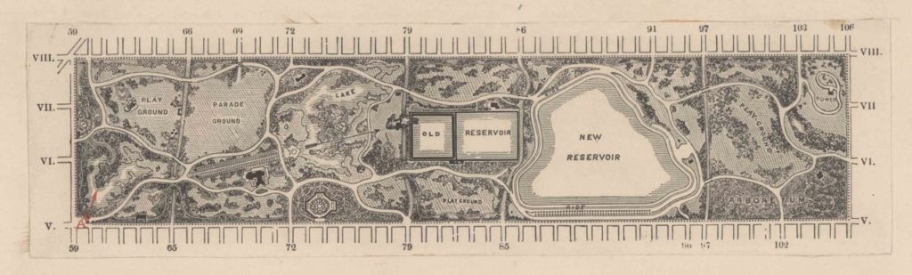
Plan of Northern Manhattan created by the Central Park Commissioners (1873). Source: NYPL.
North of 155th Street
By the mid-19th century, it was clear that the 1811 Grid Plan Commissioner’s projections that the land north of 155th Street would not be opened for a century was a bit off the mark. (They did not foresee the invention of rail-based mass transit, including railroads, streetcars, and elevated lines.) As a result, in 1851, the Common Council asked the street commissioner to create a plan for upper Manhattan. But there was no money allocated, and nothing happened.
Next, in 1860, a state law empowered a commission to formulate a street plan—especially to create something different than the grid plan. Olmstead and Vaux were hired as the landscape architects. However, in 1863, the Commission rejected their mandate and advocated for the continuation of the regular rectangular blocs.
The public’s outrage and property owners’ desire for better planning led to the Central Park Commission being awarded in 1865 the right to create a street plan north of 155th Street. The dramatic elevation changes, however, made it economically unfeasible to level the area. As Mazaraki writes,
The area’s rough and varied topography made any extension of the 1811 gridiron street pattern impossible. Elevated and exceedingly rocky in some parts, while low-lying in others, the expense of establishing a uniform grade would have been financially prohibitive even if technically possible.
A Thorough Review
Unlike the 1807 Commissioners, Green undertook a more detailed review of the topology and geographic and environmental conditions of the northern section. In 1868, he called for gridding areas in the flat valleys. However, looking at the highlands on the west side, Green questioned the cost of blasting cross streets through the rocks and the risk of making the grades so steep that the horse-drawn wagons would not be able to use the roads. As Mazaraki concludes,
Expecting that future traffic would tend to be longitudinal (north-south) he saw no need for numerous cross streets or the forcing of city lots into high ground. In this respect, Green made a major mistake. Not north-south, but east-west traffic would come to predominate and a series of lateral avenues would have served the region better.
The Commission planned three major north-south roads. It kept the historic Kingsbridge Road (which became Broadway) and created St. Nicholas Avenue out of what was formerly known as Harlem Lane. Green also proposed an eastern road that would run along the shoreline of the Harlem River. For this, a new bulkhead line was required. Where avenues such as Eighth, Ninth, Tenth, and Eleventh intersected with each other or with the shore drive to form small triangular plots, Green called for a series of small parks.
Green’s interest in parks also led him to preserve the views of the Hudson River from the hills of northern Manhattan. From this wish emerged an eight-acre park at Fort Washington Point, forming the kernel of today’s Fort Tryon Park. Later, between 1915 and the early 1940s, the City purchased the land that makes up the forested Inwood Hill Park at the northern tip.
In the end, Green created a hybrid plan. In the lowlands, the grid plan was continued, while in the highlands, the roads and blocks followed the land’s natural contours. However, unlike Manhattan below 155th Street, where all blocks had an east-west orientation, the northern plan has blocks with various directions that fit more naturally into the terrain.
Beyond Manhattan
One of the of the great ironies of the 1811 Grid Plan was that its call for leveling and paving nearly all of the island led to a strong pushback. New York would get its nature yet. Central Park, though thoroughly sculpted and arranged, is one of the world’s greatest green spaces. And just importantly, Manhattan’s growing density would generate a cry for more open spaces elsewhere. In the next post, we turn to the story of how the Bronx became the borough of parks, zoos, and botanical gardens.
Continue reading the rest of the series on Manhattan’s grid plan here.